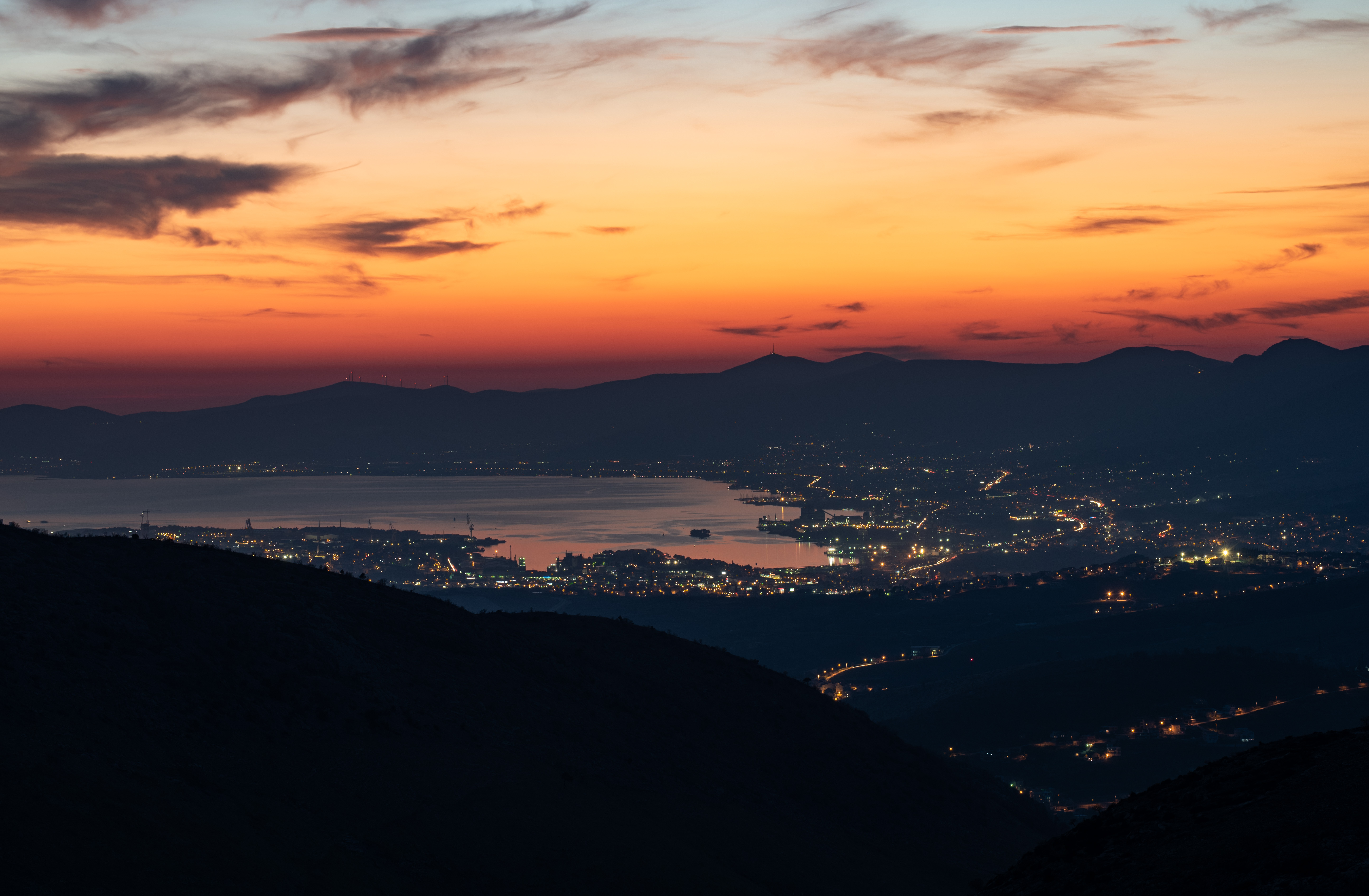
The fire is hundreds of kilometres away. How can it still worsen our air?
At the beginning of September, residents of Split, nearby towns and parts of the Dalmatian islands woke to the smell of burning, hazy skies and noticeably poorer air quality. On 6 September 2026, the Teaching Institute of Public Health of Split-Dalmatia County reported that PM10 and PM2.5 concentrations in Split, Trogir and the islands were several times higher than the values normally measured there.[1] At the same time, fire and civil-protection officials said that winds were carrying smoke toward Dalmatia from a large wildfire in Bosnia and Herzegovina, which had affected an area stretching from Kupres toward Tomislavgrad and Prozor-Rama.[2]
Episodes like this easily create the impression that a major fire must be burning somewhere nearby. In reality, smoke can cross national borders and travel hundreds or even thousands of kilometres before it disperses or is removed from the atmosphere. The World Health Organization notes that wildfire smoke can affect air quality and human health far from the fire zone itself.[4] What happened in Dalmatia was therefore not an unusual meteorological curiosity, but a clear local example of a process seen regularly in many parts of the world.
What happened in Dalmatia?
In its official notice on 6 September, the Split-Dalmatia public health institute said that PM10 and PM2.5 levels were several times higher than usual and described the air as burdened by particulate matter. Residents were advised to avoid strenuous outdoor activity, with particular caution recommended for children, older people, pregnant women and people with respiratory or cardiovascular conditions.[1]
HRT reported the same day that smoke from fires in Bosnia and Herzegovina had spread across Dalmatia. Split-Dalmatia County fire commander Ivan Kovačević said winds were carrying the smoke across an area from Split to Pelješac, while Croatia's Civil Protection Directorate also stated that the smoke and smell of burning across a broad part of Dalmatia were the result of a major fire in Bosnia and Herzegovina.[2] By 7 September, particle concentrations in Split were falling while poorer air quality had become more pronounced farther south around Dubrovnik. HRT meteorologist Zoran Vakula explained that northeasterly airflow had carried the smoke toward the Adriatic and that, because of the wind direction, it had spread hundreds of kilometres within only a few hours.[3]
That change from one day to the next illustrates why a single current reading is not enough to understand a smoke episode. A clearer picture comes from comparing several monitoring stations and following concentrations over hours or days, especially when air-quality data are considered alongside wind conditions and information about active fires.
How can smoke travel hundreds of kilometres?
Once smoke enters the atmosphere, its movement depends on air currents at different altitudes. Surface wind alone may therefore be insufficient to explain where the smoke will travel, and its impact on ground-level air quality depends heavily on whether the smoke remains aloft or descends into the layer of air people breathe. NASA documented exactly this difference during the Canadian wildfires in July 2026: where smoke remained high in the atmosphere, its effect on surface air quality was limited, while conditions worsened where it moved closer to the ground.[5]
The path of smoke is influenced by large-scale pressure systems, upper-level flow and passing fronts. In NASA's analysis of Canadian smoke transport from 14 to 17 July 2026, a high-pressure system over the central United States positioned the jet stream so that smoke from Ontario travelled toward the northeastern United States. A frontal system later helped keep some of that smoke closer to the surface.[6] Distance from a fire is therefore not, by itself, a reliable measure of smoke exposure. A community lying directly under the path of a smoke-bearing air mass can experience worse air than a place that is geographically closer to the fire but outside that path.
Why is PM2.5 especially important during wildfires?
Fine particulate matter, or PM2.5, is one of the most important indicators of air pollution associated with wildfire smoke. PM2.5 refers to particles with an aerodynamic diameter of 2.5 micrometres or less, and the World Health Organization states that about 90 percent of the total particle mass emitted by wildfires consists of particles of PM2.5 size or smaller.[4] Smoke is not made up of these particles alone. It can also contain PM10 and ultrafine particles, ozone, nitrogen dioxide, sulphur dioxide, polycyclic aromatic hydrocarbons, toxic metals and other compounds whose presence depends on what is burning.[4]
Because of their small size and ability to remain suspended in the atmosphere, PM2.5 particles can be transported over long distances and are often a useful indicator of arriving wildfire smoke.[4] A sudden rise in PM2.5, however, is not proof that a particular fire is responsible. Fine particles also come from other sources, so a more credible assessment requires several lines of evidence: changes across multiple monitoring stations, wind direction and airflow at altitude, satellite imagery and the location of known active fires.
Canada shows how far smoke can travel
The Dalmatian episode was a regional example of the same process that unfolded on a much larger scale in North America in July 2026. By mid-July, almost 850 fires were active across Canada, with more than 180 burning in Ontario.[5] On 14 July, the NOAA-21 satellite captured large smoke plumes from Ontario being carried over Quebec and into parts of the U.S. Midwest and Northeast.[5]
NASA visualizations showed smoke from the Canadian fires travelling thousands of kilometres between 14 and 17 July and spreading across large parts of the United States.[6] On 17 July, the daily average PM2.5 concentration in the Baltimore-Washington area approached 200 µg/m³, prompting Code Purple air-quality alerts.[6] The U.S. Environmental Protection Agency issued a statement the same day saying that a large portion of the United States was experiencing smoke from Canadian wildfires and directing the public to current air-quality information.[7]
The case is useful because it shows that cross-border smoke transport is not a rare exception confined to areas immediately next to a wildfire. When smoke reaches atmospheric layers with strong transport winds, national borders have no relevance to the path it follows.
Smoke in the sky does not always mean poor air at the surface
Visible smoke or a hazy sky does not automatically mean that particle concentrations near the ground are extremely high. NASA observed in July that the effect of Canadian wildfire smoke on surface air quality depended strongly on altitude: where the smoke remained high in the atmosphere, surface impacts were limited, while conditions deteriorated where the smoke moved closer to the ground.[5]
This is why a sky can look hazy or the Sun can appear unusually coloured while a nearby monitoring station still reports relatively moderate conditions. The reverse can also happen: very fine particles may be elevated even when the view outside does not look dramatic. The smell of smoke and the appearance of the sky can therefore be useful warning signs, but they are not substitutes for measurements.
Why does the development over time matter?
Air quality during a smoke episode can change within only a few hours. Dalmatia demonstrated this between 6 and 7 September, when particle concentrations in Split started to fall while the problem became more pronounced farther south toward Dubrovnik.[3] NASA described a similar dynamic in the United States, where changes in frontal systems and the vertical position of the smoke determined when it remained aloft and when it had a stronger effect on surface air quality.[6]
Current conditions are therefore best understood as one part of a wider sequence. The AirQuality.city map allows users to compare monitoring stations across Croatia, while views covering the previous 24 hours and seven days help show how an air-pollution episode developed over time.[8] If elevated readings appear progressively at several stations along the path of an air mass, that pattern can be an important clue, but it is still not proof of the source without supporting meteorological and other evidence.
How can we judge whether smoke came from a distant wildfire?
The strongest assessment comes from combining several types of information. A sudden rise in PM2.5 at one station may have a local cause, but if a similar change appears within a short period at multiple distant stations and the airflow matches the location of active fires, long-range smoke transport becomes a more plausible explanation. Satellite imagery can add another layer of evidence by showing whether a smoke plume lies along the expected path.[5][6]
It is important to distinguish measurement from attribution. A monitoring station tells us what is happening to pollutant concentrations at its location, but a PM2.5 value alone cannot reliably identify the specific fire from which those particles came. That conclusion requires air-quality measurements to be considered together with meteorological data, fire locations and satellite observations.
Air has no borders
The episode in Dalmatia in early September showed how a fire outside Croatia could change air quality along a large part of the coast within a short period.[2][3] The Canadian wildfires that same summer demonstrated the same process on a much larger scale, with smoke reaching densely populated parts of the United States and producing very high PM2.5 concentrations far from the source.[6][7]
Air quality therefore cannot be understood only through what is happening within a few kilometres of where we live. Local traffic, heating and industry can all be important pollution sources, but the atmosphere can also carry smoke and aerosols from regions hundreds or thousands of kilometres away.[4] When air quality deteriorates suddenly without an obvious local cause, it is worth looking at how conditions evolved over the previous hours, what nearby stations are reporting and whether distant events line up with the direction of atmospheric flow.
Current air quality across Croatia and the development of conditions at monitoring stations can be followed on the AirQuality.city map.[8]
Sources
- Obavijest građanima o kvaliteti zraka na dan 06. rujna 2026. godineNastavni zavod za javno zdravstvo Splitsko-dalmatinske županije2026-09-06 Accessed 2026-09-19
- Dim prekrio Dalmaciju: U zraku povišene vrijednosti lebdećih česticaHRT2026-09-06 Accessed 2026-09-19
- Popravlja se kvaliteta zraka u Splitsko-dalmatinskoj županijiHRT2026-09-07 Accessed 2026-09-19
- WildfiresWorld Health Organization2026-07-31 Accessed 2026-09-19
- Ontario Wildfire Smoke Moves EastNASA Earth Observatory2026-07-16 Accessed 2026-09-19
- Long-range Transport of 2026 Canadian Wildfire Smoke into the United States (July 14-17, 2026)NASA Scientific Visualization Studio2026-07-17 Accessed 2026-09-19
- EPA Statement on Cross-Border Wildfire Smoke and Air Quality Impact on U.S.U.S. Environmental Protection Agency2026-07-17 Accessed 2026-09-19
- Mapa zagađenja zrakaAirQuality.city Accessed 2026-09-19